Why it's trending
The sudden interest in weather radar is triggered by the National Weather Service issuing severe thunderstorm watches and warnings on Monday, July 27, 2026, for large areas of the Midwest. The FOX Weather Center reported that storms are barreling through northern Wisconsin and targeting Green Bay, with the potential for a derecho. This escalating threat has driven widespread public monitoring of radar to track storm development and paths.
Severe thunderstorms with winds exceeding 75 mph are sweeping across the Midwest, driving a surge in public use of weather radar. The National Weather Service has issued multiple severe thunderstorm watches for parts of Wisconsin, Michigan, Indiana, and Illinois on Monday, according to CBS News Detroit and FOX Weather.
The CBS News Detroit weather team declared Monday, July 27, 2026, a NEXT Weather Alert Day, stepping up forecasts as storms moved through Wisconsin and into Michigan. The National Weather Service issued a severe thunderstorm watch at 12:42 p.m. for parts of Michigan, Indiana, and Illinois, including cities like Kalamazoo, Grand Rapids, Holland, Jackson, and Lansing, in effect until 8 p.m. Eastern time.
FOX Weather noted that storms on Monday morning were barreling through northern Wisconsin and targeting Green Bay, with threats of damaging winds, hail, and a possible derecho. The utility DTE stationed more than 2,200 storm response team members ahead of the weather, including 450 additional lineworkers from eight states, as reported by CBS News.
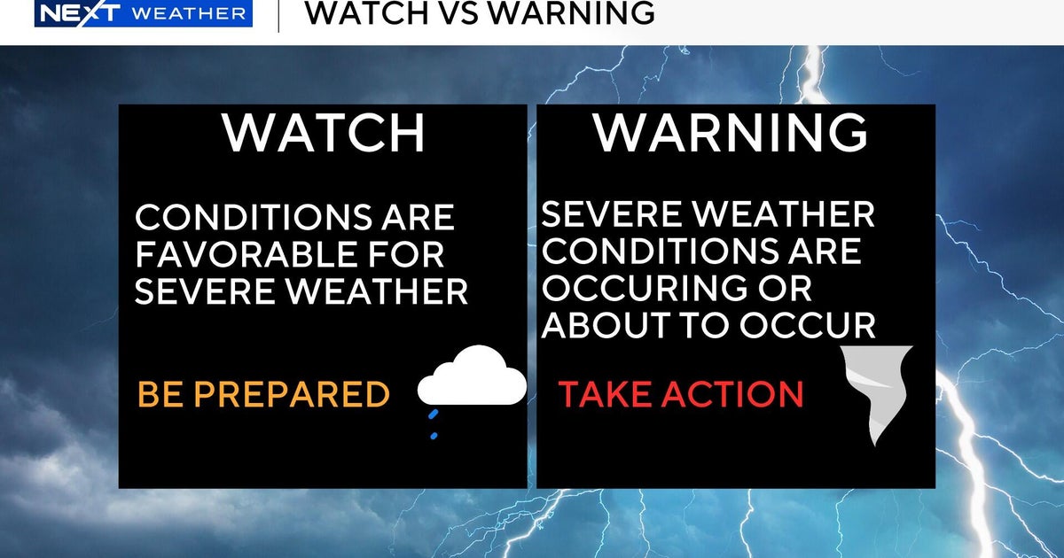
The severe weather follows an active July pattern. The National Weather Service distinguishes between a watch ('be prepared') and a warning ('take action'), both currently in effect across the region. Residents are urged to stay indoors, away from windows, and avoid downed power lines. With radar usage spiking, authorities emphasize heeding official alerts as storms continue to develop.
Timeline
- Storms form over Wisconsin
Severe thunderstorms develop over northern Wisconsin, targeting Green Bay, according to the FOX Forecast Center.
- Severe thunderstorm watch issued for Michigan, Indiana, Illinois
The National Weather Service issues a severe thunderstorm watch for parts of Michigan, Indiana, and Illinois, including Kalamazoo, Grand Rapids, and Lansing, in effect until 8 p.m. Eastern (CBS News).
- Warnings and watches in effect across Midwest
Multiple severe thunderstorm warnings are issued as storms move through Wisconsin and Michigan. The CBS News Detroit team declares a NEXT Weather Alert Day.
Questions people ask
What is the difference between a severe thunderstorm watch and a warning?
According to the National Weather Service, a watch means 'be prepared' — conditions are favorable for severe weather. A warning means 'take action' — severe weather has been reported by spotters or detected on radar, and people should take shelter indoors (CBS News).
Which areas are most affected by the current storms?
The storms are affecting parts of Wisconsin, Michigan, Indiana, and Illinois. Cities under watches include Green Bay in Wisconsin, and in Michigan: Kalamazoo, Grand Rapids, Holland, Jackson, and Lansing (CBS News, FOX Weather).
What should I do if I encounter a downed power line?
DTE urges people to stay at least 25 feet away from downed lines or anything they are in contact with. Do not cross yellow caution tape. Keep children and pets indoors (CBS News).
Join the conversation 0
Comments are reviewed before publishing.