Why it's trending
The image went viral due to its striking resemblance to a hummingbird, sparking curiosity about Antarctica and NISAR's advanced radar technology. Additionally, NISAR began making data publicly available on July 20, 2026, increasing interest.
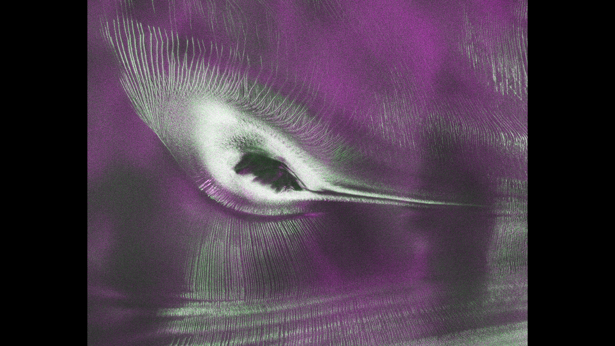
A radar image from the NISAR satellite, a collaboration between NASA and the Indian Space Research Organisation (ISRO), has revealed a hummingbird-like shape in Antarctica. The image, released as Space.com's photo of the day for July 23, 2026, shows what appears to be a small purple bird atop a mountain. In reality, the 'bird' is the crest of Nunatak Zaterjavshijsja in East Antarctica, with its 'tail' formed by an ice stream flowing northeast to the ocean and 'feathers' by crevasses from glacier fracturing.
According to Space.com, the image was produced by signal analysis engineer Seongsu Jeong at NASA's Jet Propulsion Laboratory. Jeong noted, 'First, it's a beautiful image... Then, because radar can often see through snow and deep into the ice, NISAR can observe fundamentally different properties of Antarctic ice than can be seen in optical imagery.' The NISAR satellite, described by NASA's Earth Science Division director as 'the most sophisticated radar we've ever built,' launched as a joint mission between NASA and ISRO.
The image captures glacier movements on the mountain, with crevasses formed as the glacier fractures the surface while flowing toward the ocean. NISAR's radar can see beneath the surface, providing insights into ice dynamics. The satellite began making its data publicly available on July 20, 2026, just days before the image's release, allowing researchers and the public to explore similar radar views.
This image underscores the value of radar satellite technology in studying polar regions. By revealing hidden structures in ice, NISAR can help scientists understand glacier flow and ice sheet stability, which are critical for predicting sea-level rise. The hummingbird illusion also serves as a reminder of the beauty and complexity of Earth's remote landscapes.
Timeline
- NISAR Launch
NASA-ISRO's NISAR satellite launched as a joint mission, described as 'the most sophisticated radar we've ever built' by NASA's Earth Science Division director.
- NISAR Data Goes Public
NISAR started making its data publicly available, allowing researchers and the public to access radar imagery.
- Hummingbird Image Released
Space.com published the NISAR image of Nunatak Zaterjavshijsja, showing a hummingbird-like shape, as its photo of the day.
Questions people ask
What is the hummingbird in the NISAR image?
The hummingbird shape is an optical illusion created by radar imagery of Nunatak Zaterjavshijsja mountain in East Antarctica. The 'bird's' belly is the mountain top, its tail is an ice stream, and its feathers are crevasses from glacier movement.
Why is NISAR significant?
NISAR (NASA-ISRO Synthetic Aperture Radar) is a joint mission between NASA and ISRO. It uses advanced radar to see through snow and ice, revealing hidden features and providing data on glacier movement and ice sheet properties.
Join the conversation 0
Comments are reviewed before publishing.